 NERC Data Catalogue Service
Geochemical mapping
Type of resources
Topics
Keywords
Contact for the resource
Provided by
Years
Formats
Representation types
Update frequencies
Scale
-
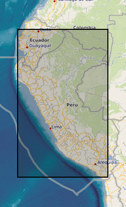
During the period 1967 to 1971 a team of geoscientists carried out a programme of regional geological mapping in parts of Peru and a low-density regional geochemical exploration survey of the Western Cordillera of northern Peru. The work was funded by the UK Overseas Development Administration (ODA - now the Department for International Development, DfID) in collaboration with the Servicio de Geologia y Mineria (SGM), Lima, Peru (now INGEMMET). The geochemical exploration project was managed by a BGS geologist/ geochemist and supported by counterpart staff from the SGM. Locational and analytical data, maps and interpretative unpublished reports were deposited at the SGM in Lima in 1971. The geochemical data are a long term asset and continued interest in the results, particularly in recent years, has required that the data be made more readily available in a digital format. Some 1345 sites were sampled and stream sediments were analysed for Cu, Pb, Zn, (Co), Ag, Mo, (As), and (V). Raw data can be obtained from INGEMMET, AV Canada, 1470, San Borja, Lima, PERU. The sample location data have been digitised from a sample site map, as the original field sample cards and the port-a-punch cards were not retrievable in 1998/99. The sample site map was a paper copy - so, although the UTM co-ordinates for locations are given to the nearest metre, the true location of the original sample sites may vary by as much as 500 m, or in some cases even more. GENP 1967-71 was a low-density regional exploration survey based on the collection of some 1260 samples at key sites within the 25,000 km2 project area - a density of approximately 1 sample per 20 km2. Data cleaned for absent and below detection limit values.
-
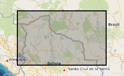
Between 1976 and 1982, the Overseas Directorate of the British Geological Survey, United Kingdom and the Geological Survey of Bolivia, Santa Cruz, carried out a major reconnaissance geological mapping, geochemical sampling and mineral exploration programme of that part of the Precambrian Brazilian Shield lying within eastern Bolivia. Previous geological work had been undertaken in the area, but this was the first time that a systematic and fully integrated survey had been attempted. The Project area is approximately 220,000 square kilometres and regional geochemical samples were collected from 8185 sites producing an overall sampling density of 1 sample per 27 square kilometres. Because of logistic problems it was impossible to sample certain inaccessible areas so the actual sampling density was 1 sample per 16 square kilometres for the 130,000 square kilometres effectively sampled. The geochemical samples were analysed in the Project laboratories in Santa Cruz and in the GEOBOL geochemical laboratories in La Paz. Uranium analyses were carried out by a commercial laboratory in the UK. The results of the Project are incorporated in 21 comprehensive reports in both English and Spanish. Twelve describe the geology, geochemistry and mineral potential of the individual 1:250,000 map areas and the remainder are devoted to the geology and mineral potential of areas of special geological or economic interest. The stream sediments were determined for: Ag, Co, Cu, Fe, Mn, Ni, Pb, Zn, As, U, B, Ba, Be, Cr, La, Li, Mo, Nb, Sn, Sr, Y, and Zr. These results are presented in an atlas as 22 single element 1:1 million scale, classed proportional symbol, point source data maps in which the symbols are overprinted on a simplified geological base map in order to facilitate rapid data interpretation. A 1:4 million scale moving average map based on a 4 x 4 km cell size and a 10 km search radius, printed alongside the symbol map, identifies the major regional variations. Raw data is available from the Geological Survey of Bolivia, Santa Cruz along with copies of the reports.